
The local authority must start by identifying existing data and the different stakeholders who possess it, and assessing quality and reliability.
Knowledge generation through digital technologies for urban and spatial planning relies on past or present urban plans and technical studies commissioned by the municipalities. To review the state of existing knowledge, the following should be examined and compared:
- available data, digitalized or likely to be, within the scope of urban planning (maps, sectoral statistic databases relative to taxation, land registry, services, etc.);
- data generated autonomously by civil society, in particular in the informal, precarious or at risk neighbourhoods, which enrich official information with expertise of use via participatory or community mapping exercises.
The prime rationale is to collect information through digital tools such as smartphones, GIS GIS Geographic information system: system designed to gather, store, process, analyse, manage and display all types of spatial and geographic data and online platforms. Particular attention should therefore be given to the mapping media (Google Maps or OpenStreetMap), data formats, the possibilities of crowdsourcing Crowdsourcing Consists in the use of information, creativity, expertise or intelligence of a large number of people through the intermediary of a platform. From an economic approach, it may be a question of distributing a large number of tasks for the lowest cost. From a collaborative, social or altruistic approach, it is a question of making use of the specialist or volunteer networks of the general public to collect or process information. , the possibilities of cooperation with mobile operators or social networks platforms (Facebook’s Safety check for instance).
Another challenge, given the rapid pace of urbanisation in many developing cities and the need for a rapid response to natural disaster, is the extent to which the data and maps are up to date. Information that is too old will not be of much use for triggering decisions. On the contrary, maps produced on the basis of the daily experiences of the population can serve as a medium for dialogue and coordination of sectorial actions.
Risk management and early warning system
Rio de Janeiro, Brazil
Digital tools to improve disaster management.
The town of Rio de Janeiro is particularly vulnerable to disasters due to heavy rainfall that leads to landslides and flooding because of massive urban sprawl. From 2010, the municipal council and civil defence (responsible for coordinating all the emergency service efforts) rallied to prevent the impact of flooding and landslides.
The town chose to develop an Early Warning System – EWS, first of all by classifying the risks on the residential, developed zones. A team mapped the areas exposed to landslides on a Google Earth map with monthly updates.
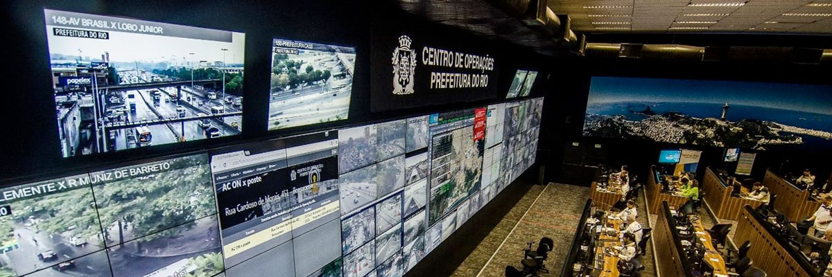
The municipality then installed additional rain gauges in the town and a weather radar to develop climate models that were monitored continuously. The data is centralised in the centre of operations in Rio developed with the company IBM. The town has installed sirens in the at risk zones and an SMS service was set up to send alerts to the members of the communities with basic training in civil defence or who expressed an interest.
To promote the awareness of the population particularly exposed to risks, detailed mapping was carried out, identifying the people with specific needs living in the at risk zones (favelas and cheap residential areas). Health officers were distributed to these areas to promote awareness in the inhabitants. These works were also an opportunity to carry out a census of the population to account for the people in safety during a disaster.
Lessons learnt
- Continuously updated data collection accelerates knowledge of the territories and vulnerable population groups.
- Simple communication mechanisms (SMS) and digital mediation (agents) provide quicker response times and facilitate exchanges between authority and inhabitant.
Share:
![]()
![]()
![]()
![]()
 Clarify expectations about digitalization of urban and spatial planning
 Perform a self-diagnosis of available and usable data for planning and crisis and disaster management
 Identify the partners and ecosystem capable of producing urban data
 Start with pilot actions to test simple solutions
 Define a roadmap to ensure public responsibility for urban planning data
 Assess, learn and enrich the data for territorial knowledge, and communicate on possible contributions