Start from an existing urban challenge, stimulate innovation and test new solutions.
Experimentation and apprenticeship must be a common theme. It is not a question of creating a digital revolution in your territory, but, on the contrary, of identifying the very concrete challenges and testing simple solutions before scaling up. The introduction of digital technology is a gradual transition that requires long-term management to match actual capacities and adapt to the needs of the territory.
Digital innovation: an approach through experimentation
As for any innovative approach, it is advisable to remain realistic and advance gradually. It is more effective for a local authority to undertake changes that can be manageable and are reasonable, to experiment with pilot actions, to refine the solutions before generalising and switching to a larger scale. A number of successful initiatives have started on a circumscribed scope (geographic, thematic or instrumental), before being taken up and extended to a broader field.
This approach by test and learn or pilot projects is particularly suitable for developing cities which often have constraints in terms of resources: to allow work to start with limited means, then increase the amplitude of the action gradually as the results turn out to be satisfactory for the users, and so attractive for the city’s partners.
To avoid investments that are too expensive or unsuitable, the identification of some particularly relevant technologies by municipal management is vital. Simple solutions, such as a page on the social networks, the listing of public facilities on OpenStreetMap, the introduction of a hotline for complaints, can already have a profound effect on the efficiency, impact, quality and perception of the services provided by a local authority.
The initial definition of the scope does not, however, remove the necessity of anticipating the change of scale or the reproducibility: the works should be done in a “flexible” manner and by iteration, taking possible future changes into consideration. The tools initially set up must be capable of integrating the increase in the volume of exchanges and data. Failing this, it will be difficult to handle broader topics, and it will be necessary to take up the process again from the beginning, losing out on the advantages of the apprenticeship.
The information system of Cape Town: support to public decision-making
Cape Town, South Africa
A predictive model based on a GIS GIS Geographic information system: system designed to gather, store, process, analyse, manage and display all types of spatial and geographic data for planning the building of infrastructure, housing and services (water and sanitation).
At the beginning of the 1990s, Cape Town launched a mapping initiative of its territory to identify vulnerable areas and facilitate decision-making. This was inspired by the “Cost Surface Model” of Durban (South Africa): this model can be used to predict the installation cost of basic services depending on the location of the residential projects, and so inform the decisions regarding the localisation of the development areas for affordable housing.
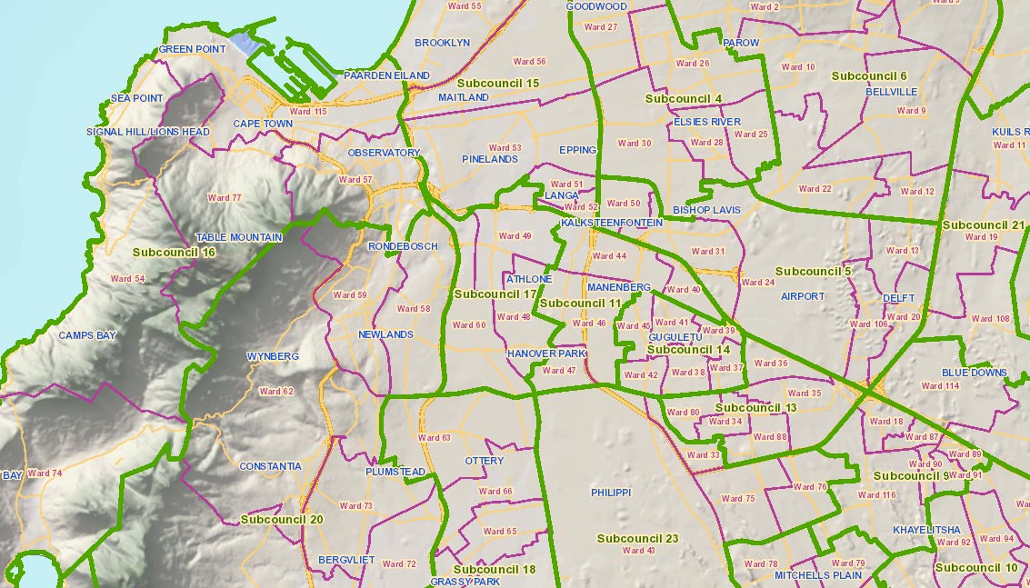
A geographic information system (GIS GIS Geographic information system: system designed to gather, store, process, analyse, manage and display all types of spatial and geographic data ) was then produced on the entire municipal area with a particular focus on coastal zones vulnerable to risk. New applications were developed to enhance this tool and, for example, optimise tax collection. Lastly, the local authority created an interactive public map that allows citizens to find the data relative to their neighbourhoods on the Internet and participate in formalising the administrative limits of the municipality.
In the long term, it is a question of improving the efficiency of decision-making in urban development.
https://citymaps.capetown.gov.za/EGISViewer/
Lessons learnt
- A clear political vision on the part of the local authority enabled the GIS GIS Geographic information system: system designed to gather, store, process, analyse, manage and display all types of spatial and geographic data to be set up in stages.
- The peer-learning Peer-learning Learning between peers, in this instance between local authorities. mechanism allowed the municipality to have at their disposal an initial already tested tool, that it subsequently enhanced with the complementary tools adapted to its needs.
Share:
![]()
![]()
![]()
 Clarify expectations about digital services
  Produce a diagnosis of your digital maturity
  Identify possible partners and map the ecosystem
  Start with pilot actions in order to test
 Define a roadmap for scaling up
 Follow, evaluate and communicate on the digital transition

