Maps to prevent risks and a citizen reporting system.
Dar es Salaam is particularly vulnerable to flooding and 70% of the population lives in informal neighbourhoods. To reduce the vulnerability to risks of these insecure residential areas and improve preparation for risk management, the municipality instigated the mapping of Tandale, one of the largest precarious neighbourhoods, in 2013.
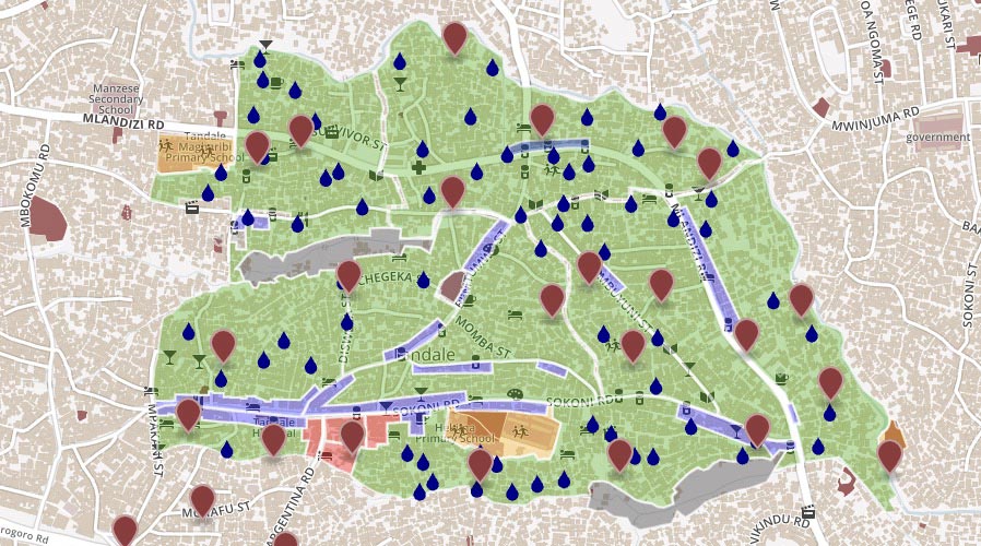
Inspired by the initiative MapKibera (Kenya), students in urban planning and inhabitants were trained and engaged to take an inventory of the existing facilities on OpenStreetMap, from an approach of awareness raising to solidarity and capacity building.
Free open source software (GeoFabrik and Tilemill) were then used to publish the maps on the Internet. Drones identified the areas most likely to be affected by flooding. This work produced maps of risk exposure and evacuation routes, also enabling the identification of the areas where flooding could cause epidemics.
In 2017, the collected, processed and published data covered 1.3 million people and fed online tools (OpenStreetMap and InaSAFE –QGIS module) which can be used by communities, without prior knowledge of programming. The funding served to create the maps, but also to set up the resources necessary for a citizen reporting exercise (identification of epidemic centre, etc.). A platform similar to Ushahidi (use of SMS or voice calls to list information) was introduced.
http://explore.ramanitanzania.org/
Lessons learnt
- The municipality engaged local human resources for data collection.
- Collaborative mapping with the inhabitants was done on free software and made available in open access Open access The making available online of digital content which may itself be free or under an intellectual property regime, but open access. In theory, open access can include access to data to allow data mining. .
 CITIIIS: City Investments to Innovate, Integrate and Sustain
 MapKibera: participatory mapping
 Risk management and early warning system
  Dhaka-Innovate: mapping of informal settlements by remote detection
  Open Cities Project: risk mapping
  Hackathon Hack Jozi Challenge
